
Maps and drawings
The holdings of the National Archives of Norway include vast quantities of maps and drawings dating from approximately 1650 to the present.
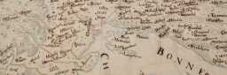
Most of these items belong together with other archival material. Typically, the maps are drawn by hand and only exist in one copy each. However, we also have printed maps, photocopies and photographs of maps.
Maps and drawings are historical sources on a par with other written documents. They are also often used as illustrations.
Most maps and drawings in the National Archives of Norway document various administrative initiatives, such as military facilities, roads and harbours. It is important to know why a map was made, as this determines what kind of information the map can offer. A map that was created in connection with flood-safety measures will typically only include the buildings and other topographical elements located within close proximity of the river. Many maps indicate plans and projects, and oftentimes, you will need to consult other sources to determine whether these were ever realised.
Maps and drawings are either stored separately or organised in the archives together with the documents to which they are linked. The materials may be itemised in individual catalogues. Maps that have not been removed for placement in special map collections are listed in the regular archive catalogues.
General topographical maps of Norway and preparatory work for these are not kept in the National Archives of Norway, but rather by the Norwegian Mapping Authority. The National Library has a complete collection of printed maps of Norway.